Topics covered in this tutorial
- Who this tool is for
- Agent Skill
- Video tutorial
- Installing the tool
- Required arguments
- Help
- Reverse geocoding
- Forward geocoding
- Examples
- Testing and dealing with broken data
Who this tool is for
The OpenCage command line interface (CLI) tool is designed for developers, data analysts, or GIS professionals who need to process files from the command line. It's best suited for people already familiar with the command line and with the concepts of geocoding.
Agent Skill / Working with AI
Are you developing with AI?
We offer an Agent Skill that includes a reference file specifically about accessing our API via the command line.
Video Tutorial
If you prefer video, over on YouTube we have a 10 minute tutorial video explaining the general concepts of geocoding and showing how to use the command line tool to geocoding CSV files.
Installing the OpenCage Command Line Interface (CLI) tool
Compatible with Python version 3.9 and newer.
pip install opencage-cli
Required arguments
When using the OpenCage CLI, you'll need to provide the following required arguments:
-
command"forward" or "reverse" -
--api-keyYour OpenCage Geocoding API key -
--inputThe input file containing addresses or coordinates -
--outputThe output file where results will be saved
Help
To get help on using the OpenCage CLI, use the
--help
option.
opencage forward --help

opencage reverse --help
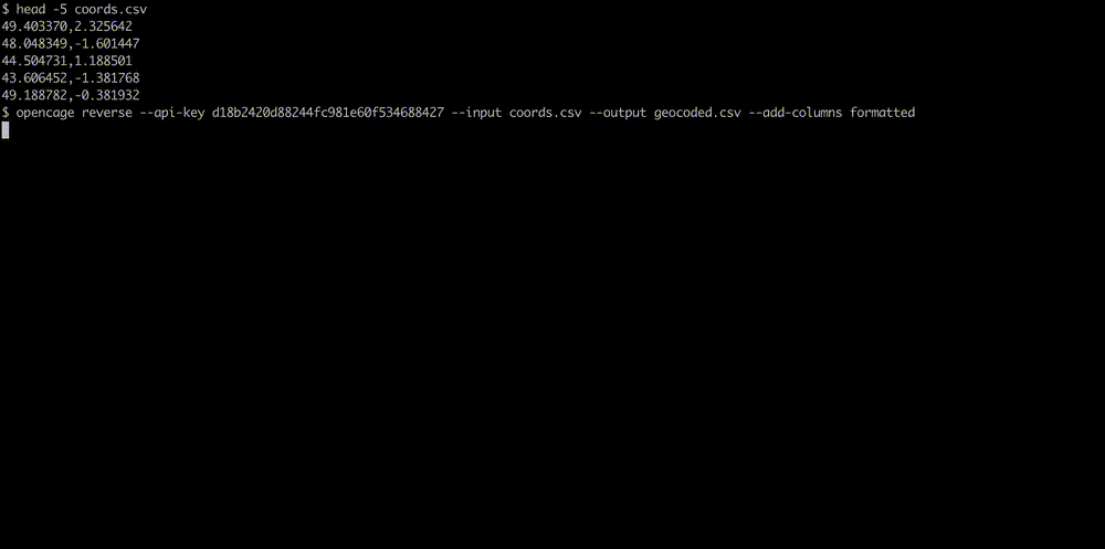
Convert coordinates to location (reverse geocoding)
You have a text file called
coordinates.csv
containing decimal coordinates (in latitude, longitude format).
We prepared a couple of
example files
for testing.
44.8303087,-0.5761911
2.345,10.2423
9.781652,124.391118
65.21345,50.234556
Geocode the coordinates and save the output in a file called
addresses.csv
opencage reverse --api-key YOUR-API-KEY --input coordinates.csv --output addresses.csv
Lookup coordinates from address (forward geocoding)
You have a text file called addresses.csv containing places:
Madrid, Spain
Milan, Italy
Berlin, Germany
München, Deutschland
Pappelallee 78/79, 10437 Berlin, Germany
Geocode the addresses to latitude, longitude coordinates and write
the output to a file
coordinates.csv
opencage forward --api-key YOUR-API-KEY --input addresses.csv --output coordinates.csv
Examples
Here we show some of the various optional flags the
opencage
command line tool makes available. For a full list use
the --help flag.
Optional API Parameters
Set optional geocoding API parameters using the
--optional-api-params
option.
Here's an example where we set
language
and
countrycode.
opencage forward --api-key YOUR-API-KEY --input paris.csv --output paris-usa.out.csv --optional-api-params 'countrycode=us,language=fr'
See the geocoding API documentation for the full list of optional parameters.
Running many parallel API requests using workers
To speed up processing of large datasets, you can use multiple
parallel workers with the
--workers
option. Maximum value is 20. This option only works for paying customers,
not free trial users.
opencage reverse --api-key YOUR-API-KEY --input coordinates.csv --output results.csv --workers 4
Before you start geocoding at high volume, please read our guide to geocoding large datasets where we explain various strategies and points to consider.
Headers
Use the
--headers
option to treat the first row of your input file as headers. For example you don't want to geocode the
'City,Country' line. The output will also have headers.
City,Country
Madrid,Spain
Milan,Italy
Berlin,Germany
opencage forward --api-key YOUR-API-KEY --input addresses.csv --output results.csv --headers
Input Columns
For a reverse search you tell the tool in which columns where the latitude and longitude are located. With
1,44.8303087,-0.5761911,medium
2,2.345,10.2423,high
3,9.781652,124.391118,low
you should set
--input-columns 2,3
(The first column is 1, not 0).
For a forward search you want to tell the tool which columns contain the combined full address. With
1,Germany,Hauptstrasse 123,12345,Frankfurt,medium
you should set
--input-columns 3,4,5,1
and the tool will geocode "Hauptstrasse 123, 12345, Frankfurt, Germany".
Add Columns
By default these columns will be added to the output:
| lat |
| lng |
| _type |
| _category |
| country_code |
| country |
| state |
| county |
| _normalized_city |
| postcode |
| road |
| house_number |
| confidence |
| formatted |
--add-columns
option:
opencage reverse --api-key YOUR-API-KEY --input coordinates.csv --output results.csv --add-columns formatted,country,postcode
Testing and dealing with broken data
-
With
--dry-runthe input file is read but no geocoding will be done. It will print warnings for any unreadable rows, for example missing columns, empty rows or invalid coordinates. -
Setting
--limit 50will only process the first 50 lines of the input file. -
With
--verbosefor each API request the full URL and API response is printed. That is useful for checking which data fields might be useful to you.
2,500 geocoding API requests/day - No credit card required